
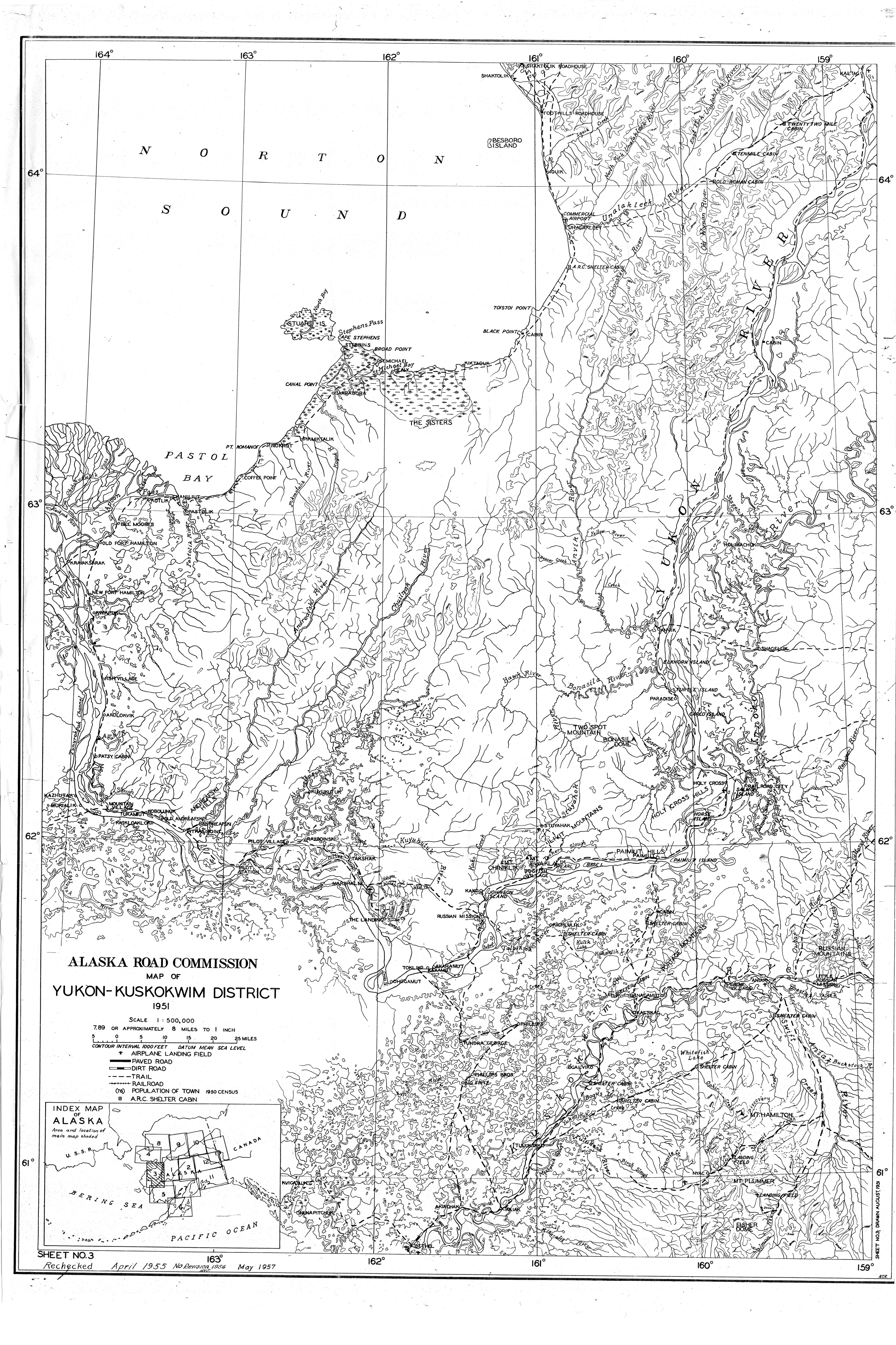


I worked for Alaska Department of Transportation in the 80s and 90s as a computer specialist. During a move I found these old maps from territorial days of the roads and trails of Alaska. I scanned these three maps, because they show the mining trails out to the Iditarod Mining District.
When Alaska became a state in 1959, one proposal was to make many of these trails into state roads. Instead it was decided to use the money to pave the gravel streets in Anchorage mostly, so most of these mining trails eventually grew over and disappeared except for the famous Iditarod sled dog trail.
